


Snowstorms to the Left of Us; Sunshine to the Right (♬Stuck in the Middle With...♬)
In some ways, I'm an outsider's standard vision of a stereotypical Canadian. I love the cold. I own snowshoes and a sleeping bag that's rated for temperatures down to -30°C. I would totally live in an igloo if I could find one decked out with electricity, cable TV, and Internet connection and a good gas-burning cooking range. I don't understand Canadians (or any other people, for that matter) who prefer(s) hot, tropical weather. Total weirdos, each and every one of
Not satisfied with just the frozen tundras of the North, I've had a fascination with Antarctica for just about as long as I can remember. I would have a Magellanic, Blackfooted or Galapagoes penguin — Hell, why not all three? — for a pet if I could get away with it. Last year, when I was starting to put together rough plans for my time abroad, I actually looked into three- to six-month contracts for menial jobs at Antarctic research stations — cooking, cafeteria server, washing dishes — as potential cheap ways to get down to the frozen desert continent. But Antarctica will be another trip for another day.
Despite missing out on Antarctica, I was determined to head as far south as I could during this trip. And that meant plenty of time spent amongst the glaciers and snow-topped peaks in Argentine Patagonia.
I was not disappointed. In fact, I was more than a little awed.

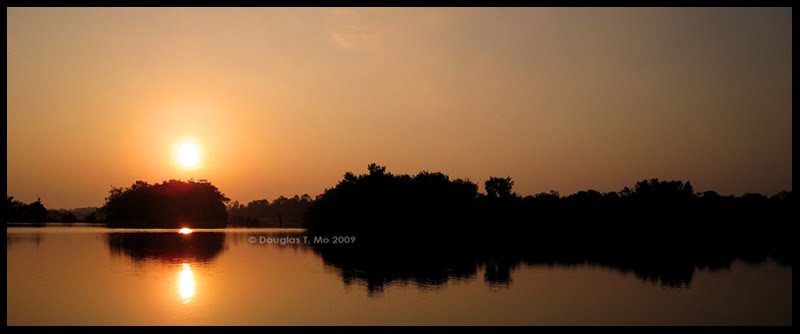
A Patagonian Sunset (Taken from just outside the American del Sur Hostel in El Calafate)
I followed a simple route through southern Patagonia. From Puerto Madryn, I continued down Ruta Nacional 3 to Rio Gallegos, before heading west to El Calafate and El Chaltén. Really, most of the story is in the pictures and out in the Patagonian wilderness, but here are my ColesNotes (or dumbed down study notes for the non-Canadians out there) reviews of the towns:

Iceburg on Lago Argentina
Rio Gallegos
The only reason to go to Rio Gallegos is because you need to go there in order to catch a bus from here to El Calafate or Ushuaia. I'd been pre-warned not to spend any more time in Gallegos than I absolutely needed to. According to the guidebooks, Rio Gallegos is a boring, dirtyish, industrial town; the only value to travellers being that it's the transportation hub for the Argentine deep south. If I had to spend any significant length of time here, I'm sure my Gallegos experience would have turned out to be Argentina's answer to Belém.
As it turned out, I did have to spend more time than I anticipated there — a whole six hours six hours in total. My bus from Puerto Madryn was supposed to arrive at 1:00pm, giving me plenty of time to catch the 2:00pm bus out to Calafate. Of course, my bus didn't get into Gallegos until 2:30pm, at which point my only option was to wait around for the 8:30pm bus. I didn't even entertain the thought of spending cash to go into town. The restaurant / café / bar at the bus terminal has WiFi and power outlets. I just sat there and drank coffee the whole time whilst faffing around on my computer. Little wonder I was completely wired when I got to my hostel in Calafate at two in the morning.

The North Face of the Perito Moreno Glacier
El Calafate
A touristy and expensive little town, Calafate is the main gateway for visitors to the Parque Nacional Los Glaciares and the glaciers fronting on to the Lago Argentino — particularly the Perito Moreno glacier. It's a mini-transport hub for buses to El Chaltén and Puerto Natales in Chile. If you can't stand dogs, don't come here — Hell, be wary of all of lower South America. Owners let their dogs run loose everywhere. I had two dogs — including one big German Shepherd — join me randomly for a two-hour stroll around town.

Approaching the Glacier at Laguna Torre (Cerro Torre is in the background)
El Chaltén
El Chaltén isn't so much of a town as it is an outpost and a gateway for trekking and camping within the Fitz Roy and Cerro Torre sections of the Parque Nacional Los Glaciares. The best part about Chaltén was that it lays within a free zone of the National Park — to visit the Perito Moreno glacier and the National Park around Calafate, one has to pay sixty Argentine pesos, each time you enter. Internet access is available in town, but in name only. Most communications out of Chaltén are done via satellite, connections with which the notoriously unpredictable Patagonian weather often wrecks havoc. Really good cervezaria along the main road, just three-hundred metres down from the Rancho Grande hostel.
Ushuaia
Ushuaia is the gateway to Antarctica — ships heading south to Antarctica leave from this "Southernmost City in the World." I didn't make it down to Ushuaia. I only added it to the list so that I could answer the inevitable, "If you wanted to make it as far south as possible, why didn't you go to Ushuaia?" questions. Hitting Ushuaia would have meant an additional forty hours on buses, as well as crossing the border to Chile and back into Argentina and vice versa — there are no direct road connections to Ushuaia through Argentina. I'll visit the city when I eventually make it out to Antarctica.

Floating Ice Fields
So, what did I do in Patagonia? I visited the Perito Moreno Glacier. I went on a full day boat-ride around Lago Argentino to see icebergs and other glaciers coming off the Patagonian ice fields. I walked on the glacier at Laguna Torre. I did a lot of trekking around the El Chaltén area. I revelled in the cold.

Fitz Roy, and the View From Laguna de Los Tres
Oh, and I nearly died.
I'm serious. I was millimetres — one wrong step, one little slip — from sliding right off a mountain, during the approach to the Laguna de Los Tres. And I got myself in that position because of stupid decision making, and a shocking lack of attention to detail.
All buses going in El Chaltén are stopped at the entrance to the town, at a small visitor's centre / ranger station. There, travellers are given a map of trekking routes around the area, along with a few words of advice. Treks around Chaltén are unguided, and are embarked upon at the trekkers' own risk. One doesn't really need a guide since the maps of the area are good, and the major trekking routes are very well blazed — one would really have to be a completely inattentive moron to get lost. That being said, there are dangers out there. The big one during the spring time is the presence of lingering ice and snow on the trails. In fact, the ranger giving us our briefing stressed to us that if we ran into ice and snow on the trails, that, "we highly recommend that you do not continue on the trail."
Fair enough, we all thought.
I attempted the trek out to the Laguna de Los Tres on my last day in Chaltén. This six- to seven-hour trek is one of two major treks in the area — getting trekkers up to the closest viewpoint of Cerro Fitz Roy. It's a somewhat difficult trek, only because the last kilometre or so involves a 500m vertical ascent — well over a 50% grade. That ascent took me over an hour.
We encountered our first snow and ice starting about three-quarters up the climb. Should have turned back, right? Well, we didn't. We were almost at the top, and I have enough experience with snow and ice in Canada that I was confident enough that we could continue.
That decision wasn't my mistake. My mistake came when I reached the end of the major climb, and had only a shallow hill to get past before getting to the Laguna de Los Tres. The hill was entirely snow-covered, but I had only a hundred meters along a gentle slope before getting to the viewpoint of the lake.
I was exhausted from the climb and also on a bit of a time crunch since I needed to be back in El Chaltén by 6:00pm to catch a bus back to El Calafate. I reached the hill at 1:30pm and knew that I needed to turn around by 2:00pm at the latest to leave me time to trek the twelve kilometres back to town. I didn't stop to check my surroundings and just automatically took what was the most well-worn path through the snow — a path that lead around the side of the hill. The problem was that all the stomping from previous travellers had compacted the snow down to ice, and I was having trouble keeping even footing. I was moving slowly, realising that my situation was precarious. But I didn't realise just how precarious my position was until I looked down to my left. That side of the hill was — given the sun-melt and refreezing at night — for all intents and purposes, a sheer ice sheet. An ice sheet sloping down the hill. Ending in a sheer cliff about twenty metres away. With no vegetation or rocks to stop a slide right off the mountain should I happen to fall. I looked back along the path and realised I was halfway along — it was just as far for me to go back as to continue until I was off the snow. So I just had to keep stepping forward, praying to God and all that is Holy, with every step, that I wouldn't slip.
Once I got off the snow, I noticed the other path over the hill. The safer route surrounded by rocks and vegetation. That was the path I took back.
Maybe it wasn't as dangerous as I'm making it out to be. I wasn't the only person to take that route that day, and, as far as I know, nobody slipped off the mountain. But maybe we were all just incredibly lucky. Sitting that evening with Ben — who had done the same trek, and made the same mistake, the day before I did — we both agreed that taking that snow trail was easily the stupidest thing either of us had done in our travels.
My forehead is twitching just thinking about it again.
The ironic thing is, in an earlier blog entry back in early October, I talked about learning how not to make stupid climbing decisions through reading Jon Krakauer's Into Thin Air.
Guess the lessons from the book didn't stick. But they will now. Especially when I'm in Nepal later in my trip.

Not Quite Spring Yet
Related Entries:
1. Belém
2. A Change in My Food Worldview


0 comments
Post a Comment