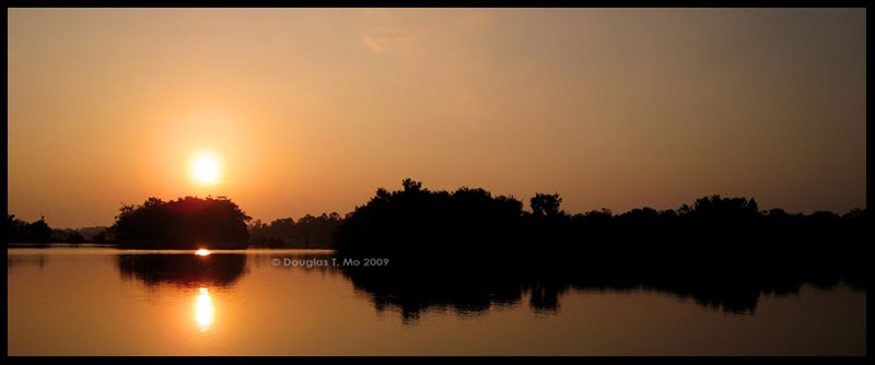



Sunrise on the Way to Cho La
Dateline: April 6th, 2010
Today, I went through Hell and back.
I really did think that Hell would be warmer than this, but the temperatures in the Himalaya remain frigid. And this is getting to be a bit of a silly refrain, but this really was, possibly, the toughest day of my life. By my count, I'm up to three "toughest days of my life" over the past four days. I'm not sure how much more of this I can take. I'm glad I took the day yesterday to rest up, but I was nowhere near 100% this morning – I was lucky if I was even 75% fit. And after six hours of hard trekking today, my left leg is a bit of a wreck.
Last night, I was in bed by 2100. I slept deeply to start off with, but my anxiousness at having to set off for the Cho La at first light had me sleeping in fits and starts from 0200 onwards. By 0445, I couldn't stay in bed any longer, and got to up steel myself for the day ahead. Protecting my left foot was a priority. I put on a pair of liner socks, then the thicker trekking socks over those to give my toes as much padding as possible. Squeezing my feet into my hiking boots was a bit of a struggle, but everything felt okay once they were on. Instead of the sharp pains I felt the previous two days, today I was faced with more of a dull throbbing. At breakfast, I popped two tablets of Extra-Strength Advil to take the edge off. At 0550, we departed from the Green Valley View Lodge and headed west towards the Cho La.
(Anal retentive note: While most literature and maps that I've seen refer to the mountain crossing as the Cho La Pass, I'm avoiding that since the name is tautological. La, in Tibetan, means "pass".)
The starting section of the day's trek was relatively easy – the trail led along gently sloping hills, leading up to a large boulder ramp that represented the main climb for the day. I was feeling okay – not great – but willing to make a go of it. Along the way to the boulder face, we had to ford a few streams – many flowing under thin layers of ice on the surface.
It was whilst crossing one of these streams that I had my first fall of the day. Either the rock I'd stepped on had a thin layer of ice on it, or I just lost my balance. The stream wasn't deep – no more than ankle depth – but I slammed my left shin into one of the larger rocks. My camera, which was around my neck, hit one of the smaller rocks. My camera showed no physical damage except for a thin sheen of ice on my polariser, where it had briefly dipped into the water. I wiped off the ice and was able to start snapping away.
My left shin, however, showed much more overt damage, with a large bruise forming and a not insignificant scrape just below my knee cap. Maybe it was the Advil dulling my pain receptors but while the shin looked bad, I felt no more than minor soreness. It was enough to be noticeable, but not enough to slow me down – at least, I wasn't moving any slower than I had been moving. It was a good thing I didn't require a lot of time to recover because within fifteen minutes we were at the foot of the wall.

Looking Down the Rock Slope
That's when the scramble began. Ascending that rock slope didn't require ropes or any rock-climbing skills, but it was steep, and the boulders were large enough, that all three of us were on our hands and knees at points, crawling over the rocks. I had to be doubly sure of my footing as we ascended that slope, which extended up about two-hundred-and-fifty vertical metres. It was slow work and we stopped about half-way up – just as we passed the 5,100m altitude mark – to rest, to get a few snacks into our bodies, and to take in the views.

Arun, Taking a Breather on the Way up to Cho La
Once we crested the top of the rock wall, we found ourselves faced with a large snowfield, and a route that lead across the icefall of the small Cho La glacier. The snow wasn't fresh. There was the telltale crunchy layer on top, showing plenty of thawing and refreezing in past days. While we weren't expending extra energy trudging in shin-deep powder, the ice layer made things quite slippery. Fortunately, the area had seen plenty of use since the last snowfall, and we were able to use the old footprints of previous trekkers and porters to guide ourselves across the glacial field and towards the pass.

At the Cho La
After a gentle ascent through the snow and a short, sharp climb up a small ridge, I stood next to a small stone chorten, with Buddhist prayer flags flapping in all directions. We were at the top of the Cho La.
It had been tough going, but I was pleased with our progress. Despite the slow pace caused by my injuries, we had gained the pass in just a touch over three hours, which is supposed to be a typical length of time taken by trekkers crossing from Dzonghla. Unfortunately, climbing to the top of the pass was just half the battle. We still had to descend into the Gokyo Valley.

Trekking – Day 11
Back in Dzonghla, I'd done a careful study of the route description provided by the Lonely Planet's Trekking in the Nepal Himalaya for the Cho La crossing. I made a note that the slope leading down to the village of Tagnag was described as "covered in scree", as opposed to the rock boulders on the slope we'd come up. When I read "scree", I was expecting the same type of surface I'd seen on the sides of volcanoes in Peru and New Zealand – heavily weathered rock fragments akin to sand. It would have been the type of surface that I could descend while landing heavily on my heels – thus taking pressure off my front of my boots. Instead, the scree produced by the glacial ice flow more resembled pebbles and fist-sized rocks.
This made for a much less comfortable descent. In fact, this type of rocky scree made the going bloody treacherous given my unsure footing. But there was nowhere to go but down. Without my injuries, I would have tried to manoeuvre quickly down the slope – practically at a medium jog – as the less pressure I put into each step would mean less time for the unstable surface to shift beneath my feet. Instead, I had to plot my steps carefully, keeping my eye out for rocks large enough to be embedded in the dirt, thus providing stable footholds. I still ended up on my butt a few times – including one section so steep and so lacking in large embedded rocks that I made the decision to sit and go down in a controlled slide.
When I made it to the bottom of the scree slope – after about an hour's work – I still wasn't home free. In front of us was about a kilometre's worth of small boulders, boulders that we had to negotiate ourselves over before we were back on level dirt track. It was amongst those bloody boulders that I suffered my second fall. I was moving a little too quickly – hopping from rock to rock – when I planted my foot just off centre of where I needed to be. I tumbled forward. I managed to stop my fall with my hands, but not before my left knee made hard contact with a rock underneath me. The impact managed to tear a few layers of skin off the knee cap – enough of a wound that we had to stop so that I could dig out my med kit and slap on some disinfectant and a dressing.
By this point, the morning's Advil had worn off and I felt a sharp pain coming from my left boot. I was afraid that the jarring of the fall had torn the damaged toenail right off, but I wasn't about to take my boot off to check while I could still walk. Still, my left side wasn't looking so hot. The banged-up big toe, bruises and scrapes on my shin, a decent chunk out of my knee cap, and slight impact abrasions on my palms had me feeling really worse for wear. As I was making repairs, a rescue helicopter ominously flew directly overhead, headed in the direction of Lobuche and Everest Base Camp.

Descent into the Gokyo Valley
There were no more incidents on the boulders, but even once I was back onto the grass and dirt pastures I still had trouble. My left leg just felt chewed up and every time I made a misstep or caught the front of my boot against a rock, pain went shooting through my left toe again. The issues with my knee and shin weren't affecting my mobility, but the pain there was just bad enough to be distracting.
We were still above 5,000m and I was moving very slowly. Arun, who was lugging about twenty kilograms of weight in my backpack, also seemed to be fatigued from the crossing as he was walking slower and taking more breaks than usual. We still had a ways to go and I was all about the destination at that point. Screw the journey. The journey became nothing more than an obstacle to overcome. Too much of my mental energy was going towards managing pain.
While we were walking down those gentle sloping pastures, Santosh got so far ahead that I couldn't see him. At the same time, Arun was way behind me. For at least a fifteen-minute stretch I was walking alone, without another soul in sight. With all the Sherpa settlements along the Khumbu Valley, it had never struck me just how isolated we were – that if we got into trouble (well, really serious trouble) even a helicopter rescue was potentially a half-day out.
Our original plan going into the day was to trek all the way out to the village of Gokyo, a further hour and a half of trekking across the Nzogumpa Glacier from Tagnag. When I finally caught up to Santosh, I made an executive decision. We were stopping in Tagnag for the night. We still have plenty of time to play with in the Gokyo Valley and we could afford to stop in Tagnag and still be out of Lukla on April 13th. We were actually making good time coming down from the pass but I didn't want to push my leg any further than necessary. Once I made my decision, we trekked for another half-hour, dropping the two-hundred vertical metres to the village.
I crossed the threshold into the Tashi Friendship Lodge at 1215. As soon as that happened, my pain management systems just shut down. My trekker's stride degenerated into a pronounced limp and I crumpled onto a bench in the dining room. I took all pressure off my left leg and tried to regain some semblance of well-being through a large mug of milk tea. I'd hardly eaten in six hours, so I wolfed down a plate of fried rice for lunch before retiring to my room to inspect the damage. My left toe didn't look all that worse for wear but my feet were extremely glad to be out of my hiking boots. There wasn't much to attend to with respect to the contusion on my shin, or the gouge on my knee, so I just kept pressure off the leg by napping away most of the afternoon. I finally limped my way back into the dining room at 1730 to grab some dinner and while away the rest of the evening playing cards.
Thankfully, today should be the last of the "Oh my God, how much harder can this possibly get?" days. Tomorrow is a short, relatively level trek over to Gokyo, and the descent down the Gokyo Valley is gentle compared to the ups and downs of the Khumbu. That's what I'm telling myself to keep my spirits up, anyway.
Altitude Stats:
Starting Altitude: 4,820m
Ending Altitude: 4,645m
Maximum Altitude: 5,420m
Minimum Altitude: 4,695m
Total Ascent: 780m
Total Descent: 960m
Related Entries:
1. Trekking in the Solukhumbu - Day 10: Attempting to Heal
2. Trekking in the Solukhumbu - Day 9: The High Point; and Low Points on the Way Down
3. Trekking in the Solukhumbu - Day 8: Success! (Everest Base Camp)


0 comments
Post a Comment